 SKC Films Library SKC Films Library |
| SKC Films Library >> General and Old World History >> Africa > Central Sub-Saharan Africa |
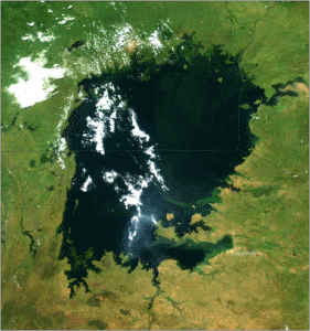
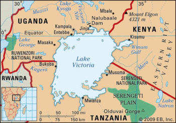
| Lake Victoria the largest lake in Africa Lake Victoria borders the countries of Uganda, Kenya, and Tanzania. With a surface area of 26,828 square miles, it is the second largest freshwater lake in the world (after Lake Superior). It has an average depth of 130 feet, and a maximum depth of 276 feet. The lake's surface is 3,723 feet above sea level. Approximately 80 percent of the lake's water comes from rain, with the other 20 percent coming from rivers and streams. The Kagera is the largest river flowing into the lake. The White Nile (called the "Victoria Nile" where it leaves the lake) is the only outflowing river. The Victoria Nile once flowed over Ripon Falls just north of the lake, but the falls have since been obscured by the Nalubaale Dam (formerly known as the Owens Falls Dam). The lake supports Africa's largest inland fishery, with cichlids being by far the most common variety. Geologically, Lake Victoria is relatively young -- about 400,000 years old -- and it formed when westward-flowing rivers were dammed by an upthrown crustal block. Geological studies have shown that the lake has dried up completely a few times in the past, with the last time being approximately 17,300 years ago. Arab traders were the first to record the discovery of the lake; a map of the lake was created by them dating back to approximately 1160 AD. The first European to record sighting the lake was John Hanning Speke (in 1858), and it was he who named it in honor of Queen Victoria of England. SEE ALSO |
| SKC Films Library >> General and Old
World History >> Africa > Central
Sub-Saharan Africa This page was last updated on 06/13/2017. |

