 SKC Films Library SKC Films Library |
|
|
| SKC Films Library >> Geography >> Physical Geography
>> Lakes,
Ponds, Lagoons |
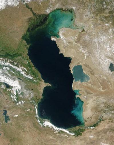
| Caspian Sea the largest inland body of water in the world The Caspian Sea has a surface area of about 143,630 square miles. It is about 750 miles north-to-south at its greatest extent, and varies from 130 to 300 miles in width. Its surface is 92 feet below sea level. The northern part of the sea is only 16-20 feet deep, the middle portion is up to 620 feet deep, and the southern portion reaches a depth of 3,300 feet. Scattered small islands in the lake have a combined area of about 850 square miles. Over 130 rivers empty into the Caspian Sea, with the Volga (which can be seen entering the lake at the top of the satellite view below), Ural, Terek, and Kura being the largest, but it has no outlets to the ocean. Evaporation removes more fresh water than the rivers can provide, so the sea is slightly saline, becoming more saline toward the southern end. Both fresh- and salt-water fish abound in the Caspian, with beluga sturgeon (source of Russian caviar) being especially abundant. The Caspian Seal is the only aquatic mammal in the Caspian. The Caspian Sea is a remnant of the ancient Paratethys Sea, which once covered much of the Mediterranean region. It became landlocked about 5.5 million years ago due to tectonic uplift and falling sea levels. It gets its name from the Caspi, an ancient people who lived to the southwest.
|
SKC Films Library >> Geography >> Physical Geography >> Lakes, Ponds, Lagoons This page was last updated on 03/20/2017. |

