

 Gerardus Mercator
(1512-1594) Flemish cartographer who devised the Mercator projection
Gerhard Kremer was born in Rupelmonde, Flanders (now part of The Netherlands); he used the latinized form of his name throughout his working life (mercator is the Latin and kremer the Flemish for shopkeeper). He studied mathematics and surveying at the University of Louvain, and became a surveyor, mapmaker, and lecturer in geography.
Within a few years Mercator had built up a reputation as a superlative cartographer and instrument maker. In 1537 he printed a celebrated map of Palestine, and the next year published his first world map on a double cardiform projection; these maps were followed by a map of Flanders in 1540. The Flanders map was prepared with such accuracy that he became the official geographer to Emperor Charles V.
In 1544, Mercator's Protestant inclinations led to his being arrested under suspicion of heresy. After seven months of imprisonment, the university authorities secured his release and he was able to go on with his research unhindered. In 1552, he moved his workshop to Duisburg in the Duchy of Cleve (in present-day Germany), where he became official mapmaker for the Duke of Jülich and Cleves.
 In 1569, Mercator published an 18-sheet map of
the world that used a projection he devised. The map was
prompted by the demand for more reliable map and chart
making created by the epic voyages of exploration that
had begun in the 15th century. Mercator's technique
projected a world map as if from a cylinder so that it
filled a rectangle on which the lines of latitude and
longitude ran straight and parallel. This enabled
navigation to be charted in straight lines on a far more
accurate basis than had been possible before.
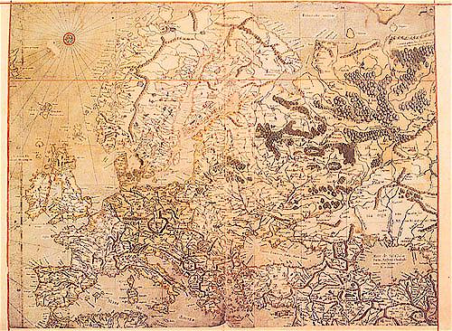
In the same year that Mercator published his world map, he embarked on a project to produce a comprehensive account of the world from the creation, illustrated with maps. He called the work his Atlas, taking the name of the mytical Greek giant who supported the world on his shoulders as his symbol -- the first time the word atlas had ever been used to describe a published collection of maps. Mercator began his project with a chronology published in 1569. An edition of Ptolemy's maps with commentary and corrections followed in 1578, and sets of maps of Europe, the Balkans, and Greece in 1585 and 1589. After his death his son Rumold completed the project, and the final work, Atlas sive Cosmographicae Meditationes de Fabrica Mundi et Fabricati Figura, was published in 1595.
Questions or comments about this page?
![]()
SKC Films Library
Geography. Anthropology.
Recreation.--Mathematical
Geography. Cartography.--Cartography.--Cartographers.
Search This Site | Usage Guidelines | About the Library | Contact Information | Navigation Help