 SKC Films Library |
| SKC Films Library >> American History >> United States: Local History and Description >> The West >> Montana |
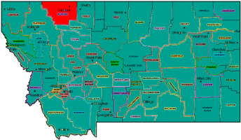
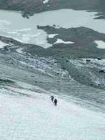
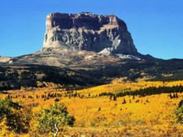
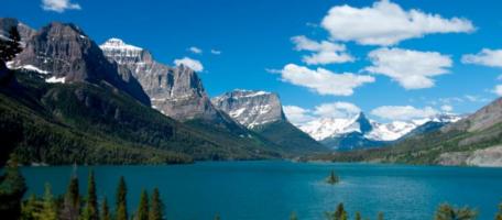
| Glacier National Park an area of about 1,600 square miles of western Montana, on the boundary between the United States and Canada location of Glacier National Park Glacier National Park was named for the more than 50 named glaciers within its borders. Blackfoot Glacier, the park's largest, covers an area of about 3 square miles. It lies about 8,000 feet above sea level on the north slopes of Mount Jackson and Blackfoot Mountain; Harrison and Pumpelly glaciers cover the south slopes of Jackson and Blackfoot. one of the 50+ glaciers in the park The area now encompassed by Glacier National Park was once the bottom of a huge inland sea. Layers of silt built up on the seabed over millions of years to form layers of sedimentary rock, and then tectonic forces deep inside the earth pushed the entire region upward. Erosion gradually wore away the softer areas of the region, while tectonic forces continued to push the region upward. The combination of erosion, glacial action and upward thrust left behind some very picturesque mountains, including 10,446-foot Mount Cleveland, the highest point in the park. Other mountains higher than 10,000 feet include Kintla Peak, Mount Siyeh, and Mount Stimson. Many of the summits within the park have never been conquered by climbers. Lewis Overthrust is another majestic geologic feature in the park. Disturbances deep in the earth's crust caused the surface to crack and ripple, and the Overthrust was created when one area was thrust up and over another, carrying many of those surface cracks and ripples with it. Colorful layers of rock can be seen along the sides of the Overthrust, much like the layers seen on the sides of the Grand Canyon. Those layers are made of some of the most pristine ancient sedimentary rocks in the world. Some of those rocks have been so untouched by erosive actions that they still bear ripple marks, mud cracks, raindrop impressions, etc. that are up to 1.6 billion years old. Chief Mountain towers above the eastern margin of the Overthrust. Some 250 lakes lie within Glacier National Park, some high in the mountains, others deep in the valleys. Lake McDonald, the largest in the park, measures 11 miles long and has an average width of 1½ miles. One of the most beautiful lakes is Saint Mary Lake, which is about 10 miles wide. Saint Mary is surrounded by mountains, except at the point where it meets the Saint Mary River. Iceberg Lake, only ½ mile long, lies on such high ground (about 6,000 feet above sea level) that it actually contains icebergs, even on warm summer days. Among the wildlife found in the park are Rocky Mountain goats and sheep, black and brown bears, moose, elk, deer, wolves, lynx, shrews, and bats. The park's many lakes, rivers and streams are abundant with eastern brook, rainbow and cutthroat trout. A wide variety of birds nest in the park, including osprey, ptarmigan, golden eagle, Clark's nutcracker, Harlequin duck, and bald eagle. Flora in the park includes dense forests of larch, spruce, fir, lodgepole pine, western red cedar, and hemlock. Alpine wildflowers such as heather, gentian, beargrass, and glacier lily abound, as do plains flowers such as pasque flower, lupine, Indian paintbrush, gaillardia, asters, and shooting stars. Created in 1910, Glacier National Park was united with Waterton Lakes National Park, on the Canadian side of the border, to form Waterton-Glacier International Peace Park, the first international park in the world, in 1932. The Peace Park was designated a World Heritage Site in 1995. LINKS OF INTEREST SEE ALSO |
| SKC Films Library >> American
History >> United States:
Local History and Description
>> The
West >> Montana This page was last updated on November 07, 2017. |


