 SKC Films Library |
| SKC Films Library >> American History >> United States: Local History and Description >> Old Southwest >> Kentucky |
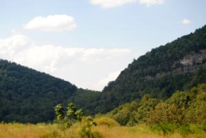
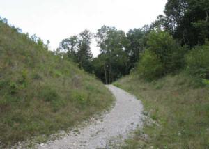
| Cumberland Gap low point (approximately 1,600 feet above sea level) in the Cumberland Mountains where the states of Kentucky, Tennessee and Virginia meet location of the Cumberland Gap The gap was formed by an ancient creek, flowing southward, which cut through the land being pushed up to form the mountains. As the land rose, the creek eventually reversed direction and flowed into the Cumberland River to the north, leaving a natural 12-mile-long path through the mountains. scenic view of the Cumberland Gap Native Americans had been using the gap for centuries before Europeans settled North America, sometimes as a trade route and sometimes as a "warpath." Dr. Thomas Walker discovered the gap while exploring the wilderness in 1750, and it was he who named it for Prince William Augustus, Duke of Cumberland, who had many places named for him in the American colonies after the Battle of Culloden. In 1775, Daniel Boone, hired by the Transylvania Company, led a company of men to widen the path through the gap to make settlement of Kentucky and Tennessee easier. The Wilderness Road, as the trail came to be known, was widened in the 1790's to accomodate wagon traffic. It is estimated that between 200,000 and 300,000 men, women and children passed through the gap on their way into Kentucky and the Ohio River Valley before 1810. Through most of the 20th century, US-25, a windy two-lane highway went through the gap. In 1996, the highway was replaced with the four-lane Cumberland Gap Tunnel, which goes under the mountains. The original trail was then restored and is now the "focal point" of Cumberland Gap National Historic Park. the Cumberland Gap as it looks
today SOURCES SEE ALSO |
| SKC Films Library >> American
History >> United States:
Local History and Description
>> Old
Southwest >> Kentucky This page was last updated on April 10, 2018. |


