SKC Films LibrarySKC Films Library
SKC Films Library >> American History >> United States: Local History and Description >> South Atlantic States >> Georgia
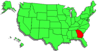
Georgia on the mapFacts and Figures

Georgia was named for King George II of England

Location South Atlantic coast
Bordered By
South Carolina, Florida, Alabama, Tennessee, North Carolina

Total Area (rank) 59,441 sq mi (24th)
Greatest Distance E-W 250 mi
Greatest Distance N-S 315 mi
Geographic Center 18 miles southeast of Macon
Coastline 100 mi
Highest Point Brasstown Bald; 4,874 ft
Lowest Point Atlantic coast; sea level

Population (rank) 9,992,167 (8th)
Largest Cities
Atlanta (420,003), Augusta (195,844), Columbus (189,885),
Savannah (136,286), Athens (115,452), Sandy Springs (93,853), Macon (91,351), Roswell (88,346), Albany (77,434), Johns Creek (76,728)

Capital Atlanta
Local Administration
159 counties

Principal Industries textiles and apparel, transportation equipment, food processing, paper products, chemical products, electric equipment, tourism
Principal Manufactures
Agricultural Products peanuts, vegetables; poultry and eggs, cattle, hogs, dairy products
Minerals kaolin, granite, barite, bauxite, talc

First Explored By Hernando de Soto, in 1540
First Permanent Settlement
Savannah, in 1733
Ratified Constitution (rank)
January 2, 1788 (4th)

SEE ALSO
South Carolina
Florida
Alabama
Tennessee
North Carolina
Savannah
Albany
Hernando de Soto

Questions or comments about this page?

SKC Films Library >> American History >> United States: Local History and Description >> South Atlantic States >> Georgia

This page was last updated on May 04, 2017.