SKC Films LibrarySKC Films Library
SKC Films Library >> American History >> United States: Local History and Description >> New England >> New Hampshire
Facts and Figures

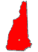
silhouette map of New Hampshire

Origin of Name New Hampshire was named by Captain John Mason after Hampshire, England

Location New England
Bordered By
Maine, Massachusetts, Vermont

Total Area (rank) 9,351 sq mi (46th)
Greatest Distance E-W 93 mi
Greatest Distance N-S 130 mi
Geographic Center 3 miles east of Ashland
Coastline 13 mi
Highest Point Mount Washington; 6,288 ft
Lowest Point Atlantic Coast; sea level

Population (rank) 1,323,459 (42nd)
Largest Cities
Manchester (109,565), Nashua (86,494), Concord (42,695), Dover (29,987), Rochester (29,752), Keene (23,409), Derry (22,015), Portsmouth (20,779), Laconia (15,951), Claremont (13,355)

Capital Concord
Local Administration
10 counties

Principal Industries machinery, electric equipment, rubber and plastic producrs, tourism
Agricultural Products nursery stock, apples; dairy producrs, eggs; cattle
Nonfuel Minerals granite, quartz, sand and gravel

First Explored By Martin Pring in 1603
First Permanent Settlement
at Odiorne's Point (now part of Rye) in 1620
Ratified Constitution (rank)
June 21, 1788 (9th)

SEE ALSO
Maine
Massachusetts
Vermont

Questions or comments about this page?

SKC Films Library >> American History >> United States: Local History and Description >> New England >> New Hampshire

This page was last updated on June 20, 2017.