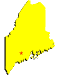
 Facts and Figures Facts and Figures Location New England Location New England
Bordered By New Hampshire
Total Area (rank)
35,387 sq mi (39th)
Land Area (rank) 30,865 sq mi (39th)
Greatest Distance E-W 207 mi
Greatest Distance N-S 332 mi
Geographic Center Piscataquis, north of
Dover
Coastline 228 mi
Highest Point Mount Katahdin; 5,268 ft
Lowest Point Atlantic Coast; sea level
Population (rank)
1,274,923 (40th)
Largest Cities Portland (63,635), Lewiston
(35,922), Bangor (31,550), South Portland (23,553),
Auburn (23,313), Biddeford (21,685), Augusta (18,618),
Westbrook (16,051), Waterville (15,758), Brunswick
(14,816)
Capital Augusta
Local Administration 16 counties
Principal Industries
manufacturing, agriculture, fishing, services, trade,
government, finance, insurance, real estate, construction
Principal Manufactures paper and wood
products, transportation equipment
Agricultural Products potatoes,
blueberries, apples; seafood, poultry and eggs, dairy
products, cattle
Nonfuel Minerals cement, construction
sand and gravel, crushed stone
First Explored By John
Cabot, in 1498
First Permanent Settlement Popham Colony, by
English settlers in 1607
Admitted to Union (rank) March 15, 1820 (23rd)

John Cabot
Questions or comments about this
page?
|


 Facts and Figures
 Location New England